
Nova Scotia 7-07
Nova Scotia. Never been there! My wife was going away for five days on a business trip and not wanting to stay home and “watch the farmâ€Â, I decided a road trip was in order. It came down to two destinations. Hudson River Valley or Nova Scotia. The weather forecast called for heat in the 90 in the HRV and in the mid 70s to low 80s in Nova Scotia. Plus Nova Scotia “required†at least two ferry crossings, one of them on the high speed CAT! It was a no brainer. Canada here we come!
I left work in Canton Massachusetts at 2:30 PM on Tuesday, July 12. My goal was Bar Harbor, Maine. I figured I’d get to Bar Harbor on Tuesday, get a room, and on Wednesday make it across the Canadian border to St. John, New Brunswick. Once in St. John, I’d take a three hour ferry ride to Digby, Nova Scotia.
The roads were just about vacant once I cleared Boston, the weather was perfect, the bike was running very well, and I felt good. I passed Bar Harbor and made it to the Canadian border, stopping inCalais Me for the night. From Bangor I took Rt9, also know as the “airline†or the “whales backâ€Â, depending on who you talk to. I used to hunt extensively in this area as I have access to a trappers cabin in Aurora ME., right off the airline, but I’ve not been here in twenty years. Nothing’s changed. Like time stood still. Two deer and one moose is the animal count so far.
I awoke on Wednesday at 4AM (Eastern Time), crossed the border at about 5AM ET, and high tailed it to St. John for a 9AM (Atlantic Time) ferry departure. A distance of about 100 miles.
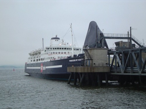
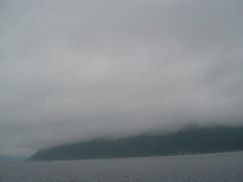
The weather “spitted†on and off the whole ride and the fog was as thick as Maine clam chowder! The ferry ride across to Digby was uneventful. The fog was so bad you could not see the bow from the stern! Thank God for radar. Nothing to see with the fog so I slept the whole way across.
A couple of points about these ferry rides. I suggest you bring at least four good tie downs with you. The ferry will supply rope to tie your bike down with, but unless you’re an old salt and know your ropes, I wouldn’t trust knots! The folks on both sides of my bike had no idea what they were doing. Here’s a picture of their seamanship.
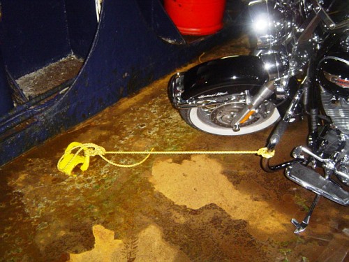
I let them finish and go on deck and then I resecured their bikes properly. Not so much for them as I didn’t want their bikes to fall into mine! When we went to the deck to retrieve our bikes, they commented that the deck hands must have secured their bikes better, which they were extremely thankful for. I admitted nothing, but commented that those deck hands really know how to tie a nice truckers knot!
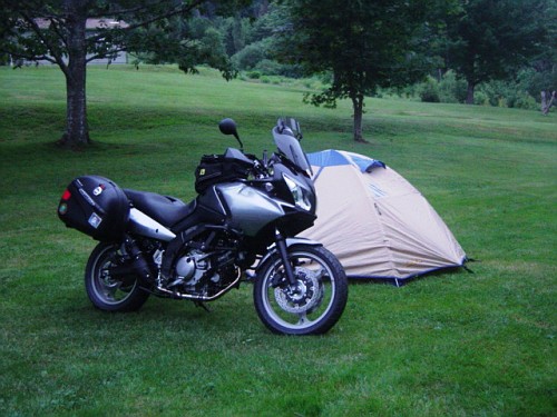
Once in Digby, reality set in. This isn’t Martha’s Vineyard! It was nearly 350 miles from Digby to Port Hastings, where Cape Brenton Island starts! I started out on the Evangeline Trail and rode this for a couple hours, but it doesn’t really run along the ocean and it was no different than riding a road in Maine or New Hampshire, so I cut over to Rt 101 which hooks up with Rt 14 and Rt 102 over to Rt 104 and the Canso Causeway, which is the only way to get from Nova Scotia proper to Cape Brenton. My destination for the night was Whycocomagh and the Provincial Campground there, which was another hour from Canso Causeway. I’m here to tell you, these Provincial Campgrounds are fantastic. Very clean rest rooms, showers that are better than some motels I’ve stayed in and the grounds are like a golf course. And deserted! Five other campers and I were the only ones there. I set up my tent, leaving all my gear on because the mosquitoes and the gnats were ruthless!I figured I’d wonder over to introduce myself to my camping neighbors. I introduced myself and realized that these folks were Japanese and didn’t speak a word of English! They quickly ran to get their electronic translator, but sign language was enough laugh about the bugs and say goodbye.
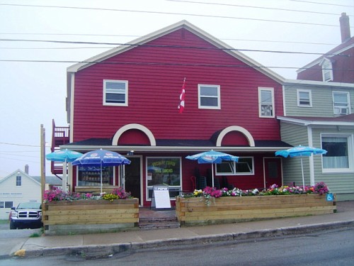
Once my tent was set up, I ventured down the road to Alice’s Restaurant for dinner. Ugh! An $18 TV dinner. Advertised as “fresh seafood platter†. NOT! Unfortunately, this is the only restaurant open for miles around. Due to a real lack in tourism for the last couple of years, lots of restaurants, gas stations and motels are closed. The local folks tell me it’s a combination of bad weather, the US dollar on par with the Canadian dollar and gas at over $5 a gallon, has really hurt business. Back to the campground in a light drizzle and off to sleep, but not before putting the bike some distance from the tent, letting the bugs descend upon it’s CO2 emissions, and running for the tent and diving in before and little b-tards got in. Three made it and paid the ultimate price!
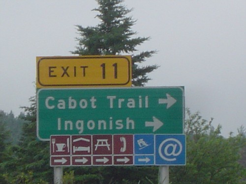
It rained all night, but stopped about 4:30AM just as I was waking up. I packed up quickly, and hit the road at 5AM. Destination, Cabot Trail!But first I had to find internet access and do some work. Lots of my staff are on vacation so I knew I’d need to stay in touch. No big deal, the internet allows me to take a vacation like this, at a moments notice, and still keep tabs on business. Nova Scotia is very progressive when it comes to the internet. The highway signs will have “@†insignias at certain exit signs letting you know there is free internet access in the various towns.
I stopped at Baddeck for breakfast and had a conversation with the owner of a little bakery about how a 650cc motorcycle is not a proper bike for long distance touring. He saw my Alaska and other destination stickers and the dual mufflers on my bike and being relatively knowledgeable about motorcycles, offered that it’s a good thing I chose the 1000cc version of the Suzuki V Strom rather than the 650. He was quite crestfallen when I informed him that all those trips and all those miles were done on a 650 V Strom and that my second muffler was a fake. Ouch!
I sat across the street from the bakery, under a fudge shop’s canopy, and accessed the internet and did a bit of business before moving on.
Now folks that know me, and have toured with me, know I like one thing more than just about anything else, and that’s a ferry!
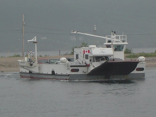
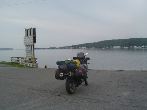
So when I saw the sign that announced “Stay Right for Ferry to Cabot Trailâ€Â, guess which way I went? This ferry crosses a little bay, St Ann’s Bay, and reconnects with the Cabot Trail.
This is a cable drive ferry. It will be one of three that I’ll use while on the trip. A cable ferry has a heavy cable strung from one shore to the other, and the ferry “pulls†itself along the cable to get from one shore to the other. Very efficient and extremely safe and easy to pilot. Unless the cable breaks, then I bet it’s one hell of a ride!
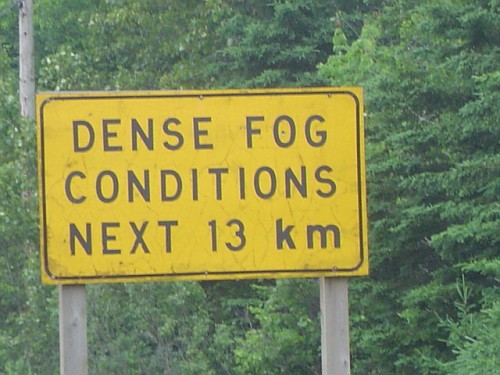
Once across St Ann’s Bay, the fog set in like you read about. At times my speed was reduced to 10 mph and my fear was being rear ended rather than hitting something. As we ascended Smoke Mountain (It’s called this because it’s usually in the “smoke†) It was so bad, you couldn’t see the guard rail on the opposite side of the road! You’d be riding along at 10 mph and out of nowhere a bicycle rider would appear. And since they do not have tail lights, they would startle you to no end! Fortunately, there was extremely light traffic and once down the other side, visibility improved somewhat.
Too bad, they tell me the view on this side of the island is spectacular! Guess it will have to wait till another visit.
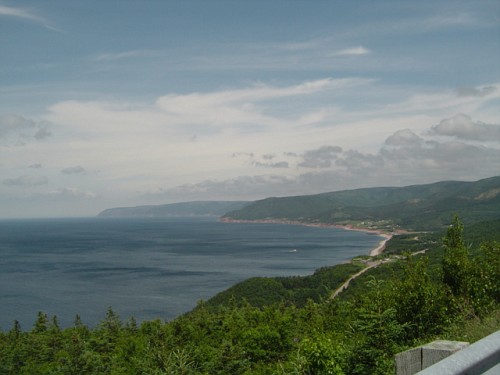
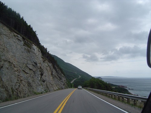
This fog persisted all the way up the “right side†of Cape Brenton until Neils Harbor, and then the sun broke out and the rest of the Cabot Trail was traveled in beautiful sunshine.
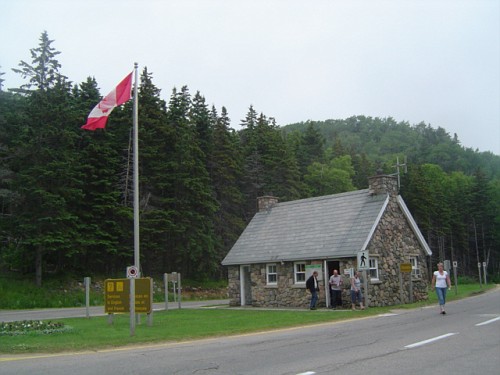
As you enter Cape Brenton Highlands National Park, you will be faced with a moral dilemma. Here’s the deal. There is a check point that you can elect to go through, and pay $6.90 for a tourist pass, or you can simply go around it and continue on. I stopped and inquired about this. I was told it is an “honor systemâ€Â. If you are going to “visit your grand-mother†and not simply sight seeing, go right on through. I paid the $6.90. Figured it was good karma and received a nice map!
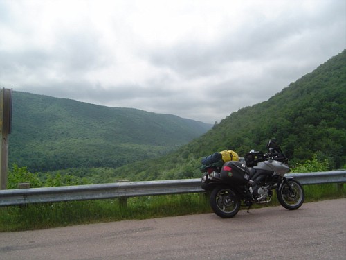
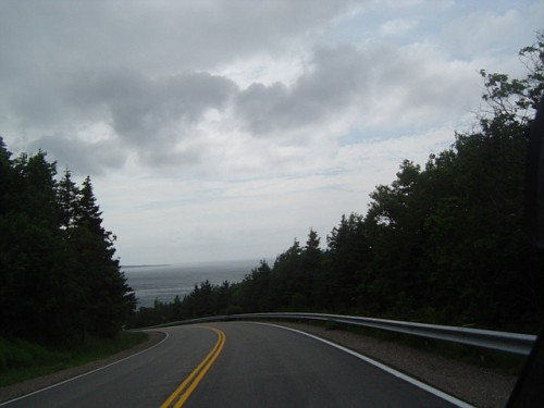
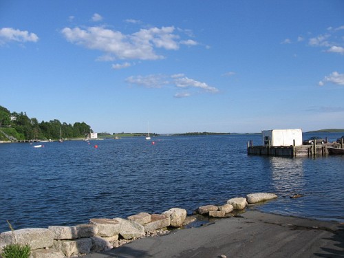
From here you cut across the island to the “left†side. ( HINT: Doing the Cabot Trail counter clockwise allows you to be on the outside of the road for the entire trip) The scenery is simply breathtaking! Very much like the Pacific Coast Highway in California. Mountain top winding roads right at the waters edge. I stopped many times to scan the ocean for whales with my binoculars and was rewarded with three sightings. You look for the “spout†as they come up for air, you know – “Thar She Blows!†and you’ll see the flukes as they dive back under. Great theater!
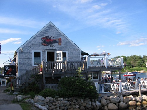
My stomach was telling me that it was time for lunch. I stopped in the little seaside town of Cheticamp. Found a nondescript little restaurant “The Rusty Anchor†that offered a deck overlooking the ocean and ordered a boiled lobster. Perfect! In fact, it was so good, I ordered another! Such a pig! But it was worth it and I told myself I wouldn’t eat supper to make up for it.
After lunch, it was more winding mountain top roads with great sweepers and wonderful views!
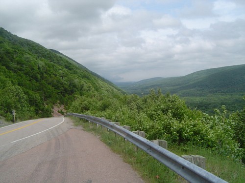
But this was to come to an end. Just as I exited the Cabot Trail, it started to rain. This rain would follow me for the next two hours to my destination for the evening, Boylston Provincial Park on Chedabucto Bay. It wasn’t a heavy rain and my gear worked perfectly to keep me dry.
My GPS led me directly to Boylston Provincial Park. Once I checked in, the Ranger didn’t assign me a campsite. He said “Take any one you like, you’re the only one here!â€Â
I picked out a site on the pond, set up camp and then went to Guysborough for something to eat.

Guysborough is a neat little town that time forgot. Only two restaurants were open. I picked the local pizza joint and had a slice of pizza and a coke. I kept it light as I needed to make up for the two lobsters.
The crack of dawn found me on the road down to the southern coast and on to the Marine Drive…………Nothing eventful, but I did get another ferry ride! I had breakfast in a little town called Indian Harbor. Wish I could remember the name……..
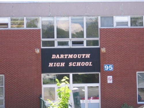
From there is was over to my hometowns “Sister Cityâ€Â….Dartmouth NS. Beautiful medium size city. It was some kind of tall ships event so it was very crowded. But it was fun to look at the ships in the harbour.
From there it was over to the Lighthouse Route. This would take me to Yarmouth and the High Speed Cat Ferry back to Portland Maine. The Lighthouse Route has some interesting stops along the way. Very nice vistas, but because of the fog, I couldn’t see too much until the fog lifted.
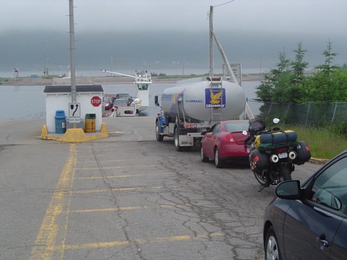
I got to the Ferry Terminal a couple hours before it was set to sail. There were a couple dozen motorcycles ready to load, and some really wet Harley riders that I’m sure expected better weather.
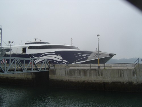
This High Speed Cat is simply amazing. I don’t know how many cars, campers, trailer trucks and motorcycles it can hold, but it’s a bunch!
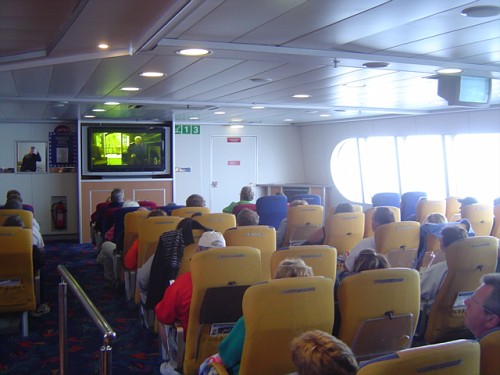
We loaded up and tied down and head for the passenger deck. This thing has three movie theaters. Two showing movies….One for kids, one for adults and one showing a NASCA race.
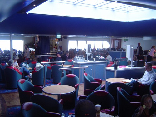
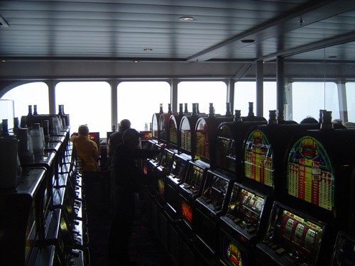
It also has a couple of eateries and a casino.
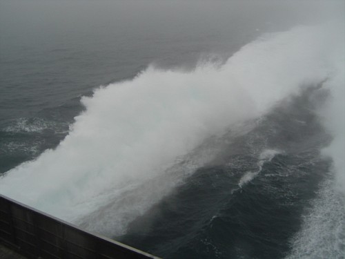
The fog was thick as Pea Soup! And once out of the harbour we were barreling along at 40+ MPH! Besides radar, this boat has some type of thermal imaging to look through the fog. Very neat………..
The rest of the trip was uneventful. Pulled into Portland Me around 10pm and went to the hotel I had reserved for a ‘cold one†and a good nights sleep…………
Hope you enjoyed this little write up……………
ADVERTISEMENT:
This web site is part of my income stream. If this article was helpful to you, you might want to throw a few bucks at me via paypal rvb100@comcast.net Not necessary, but certainly appreciated! If you have any questions, I can always be reached at rvb100@comcast.net Thanks RoyB